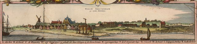
Early Map of the Eastern U.S. Shows Mohican Villages and the town of New York, I mean New Amsterdam, in New Belgium...
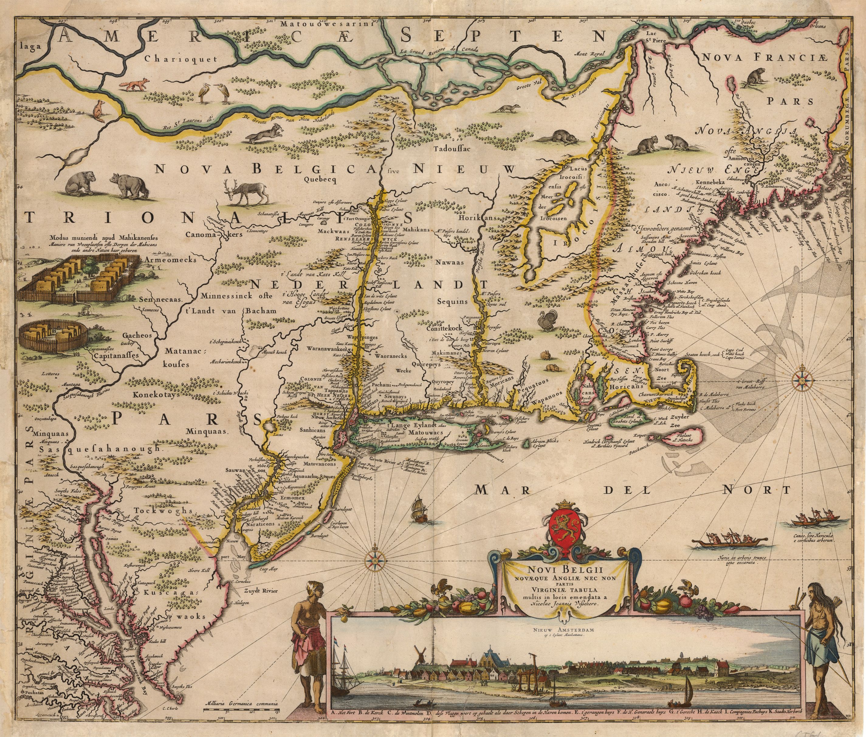
Novi Belgii Novaeque Angliae Nec Non Partis Virginiae Tabula...
By: Nicolaus Johannes Visscher
Date: 1656 (Published) Amsterdam
Dimensions: 18.25 x 21.8 inches (46.4 x 55.4 cm)
This important Visscher map of the northeast region of North America is one of the few obtainable examples of a map depicting the area while it was yet under Dutch control and is highly sought after. An inset provides an interesting view of New Amsterdam situated as it was on the southern end of the island. It is the third known engraved view of New York, with the wooden stockade which would later become the wall of Wall Street fame clearly depicted.
Publication of the map took place as the Dutch were attempting to retain their holdings in the New World. It was a firm statement concerning their establishment of a colony there, along with their aspirations for maintaining a long-term presence. The information contained in the map is encyclopedic in scope, as Visscher filled it not only with geographical details, but also with specific information such as the names of many indigenous peoples, the known flora and fauna, and information of note for safely navigating the waters off the coast.
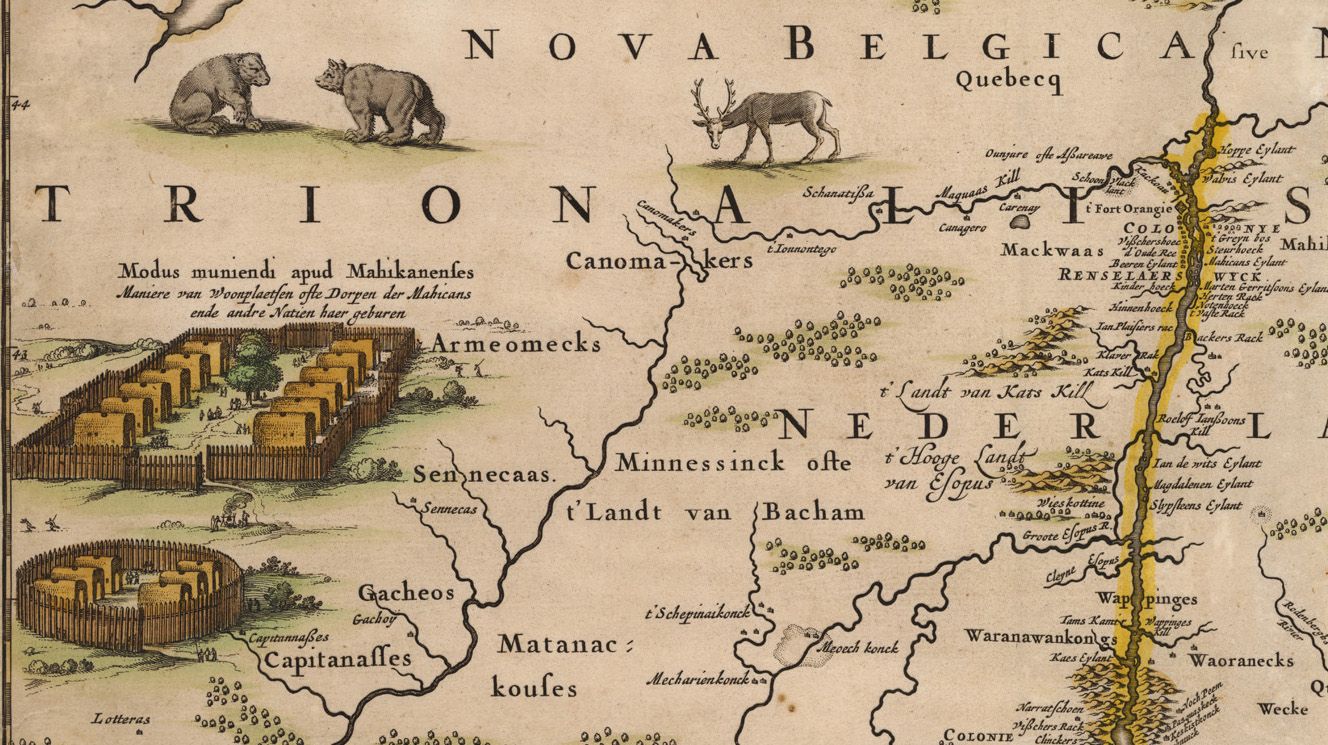
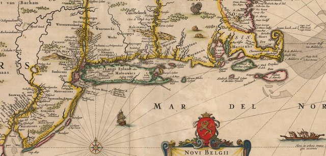
Vignettes inland depict villages of indigenous peoples, and a large number of animals caper throughout the vast unsettled regions. This second state map depicts Fort Kasimer on the Delaware River, a fort formerly known as Fort Nassau, which Peter Stuyvesant had dismantled and moved from the eastern to the western side of the river in order to menace the Swedish and to re-assert Dutch jurisdiction of the region. Presence of both British and French territories is noted according to the settlements named. Visscher used several languages in various places on the maps, including Dutch, Latin, English and French.
Have questions about this map or would like to see an old map of somewhere else in the world? Comment below.
Like antique maps and history? Follow me on Steemit and visit my website where you can buy antique maps with bitcoin (https://www.hjbmaps.com)
We also sell fine print reproductions at (https://www.thevintagemapshop.com)
This post has received gratitude of 3.07% from @appreciator courtesy of @mapman5000!
You got a 5.85% upvote from @upmewhale courtesy of @mapman5000! Earn 90% daily earning payout by delegating SP to @upmewhale.