Why Is Hurricane Irma So Powerful?
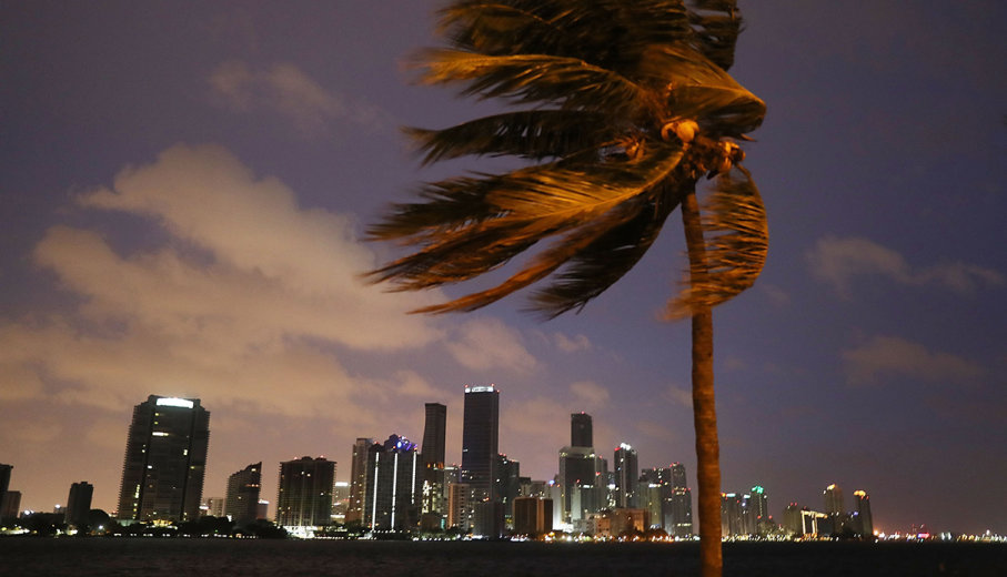
 The skyline of Miami looms as Hurricane Irma starts to reach Florida on Sept. 9, 2017.
Hurricane Irma has steamrolled its way through the Caribbean, leaving death and incomprehensible destruction in its wake. Now forecasters are looking ahead and project that it will make landfall on Florida on Sunday, with those in South Florida already feeling its effects.
But this isn't a normal hurricane. It's a monster. In a Sept. 9 news conference, Florida Gov. Rick Scott said, "Our state has never seen anything like it [the hurricane].
Fueled by abnormally warm waters and low wind shear, Irma was first a Category 5 storm, meaning it could sustain winds of at least 157 miles (252 kilometers) per hour. However, when it made landfall on the Leeward Islands, located to the south and east of Puerto Rico, Irma's sustained winds were clocked at over 185 miles (295 kilometers) per hour before the recording station went offline, a record for the islands. According to NASA, this is the strongest recorded Atlantic hurricane outside of the Gulf of Mexico or north of the Caribbean. The windspeeds are terrible, and so is the storm's extent.
"Hurricane-force winds extend 50 miles (85 kilometers) from the center; tropical-storm-force winds extend up to 185 miles (295 kilometers)," NASA wrote.
The Atlantic is currently in the midst of hurricane season, so it's not strange to see powerful hurricanes threatening the region, but Irma is an historic storm, and it arrived hot on the heels of Hurricane Harvey, which inundated Houston, Texas, with never-before-seen rainfall. But even after Irma completes its reign of terror, another hurricane (Jose) is picking up speed in the Atlantic, and there are fears that it will track a similar path to Irma, devastating already heavily damaged island nations. As CNN notes, three hurricanes are active in the Atlantic, the first time that's happened since 2010.
One thing's for sure, 2017's Atlantic hurricane season is an abnormal one, and climate change has a part to play in the ferocity of Irma.
Tropical cyclones are low-pressure volumes of air that form over oceans that are 79 degrees Fahrenheit (26 degrees Celsius) or warmer. As these vast, spinning weather systems gain energy, they suck in moist air from lower altitudes. This warm air rises, cools and the moisture it contains condenses at higher altitudes, feeding the typical spiraling clouds associated with hurricanes. In Irma's case, its clouds are over 12 miles (20 kilometers) high, a testament to how much energy is in the system.
As the hurricane forms, deeper water in the ocean is driven to the surface. Typically, deeper water is cooler, so over time as the surface is cooled, energy supplying the storm is cut off and the storm loses momentum. But as our atmosphere warms under global warming, our oceans also are heating up, pushing cooler ocean layers deeper. As the Atlantic Ocean is 1.8 degree Fahrenheit (1 degree Celsius) warmer than average, Irma took advantage of this by forming earlier and for longer, fueled by a warmer ocean. More energy equals a stronger tropical cyclone, stronger winds and a more devastating hurricane.
But the situation is more complex than that. As our planet warms, the speed difference between upper and lower altitude winds – known as "wind shear" – should increase. Atmospheric models predict this will quench energy from Atlantic hurricanes, potentially stopping them in their tracks. Currently, however, the atmospheric layers over the Atlantic are experiencing low wind shear, helping Irma become, by all intents and purposes, a "perfect storm."
In short, the situation is complex, but Irma is undoubtedly being supercharged by the effects of climate change heating our oceans.
Hi! I am a robot. I just upvoted you! I found similar content that readers might be interested in:
http://science.howstuffworks.com/nature/natural-disasters/why-is-hurricane-irma-so-powerful.htm