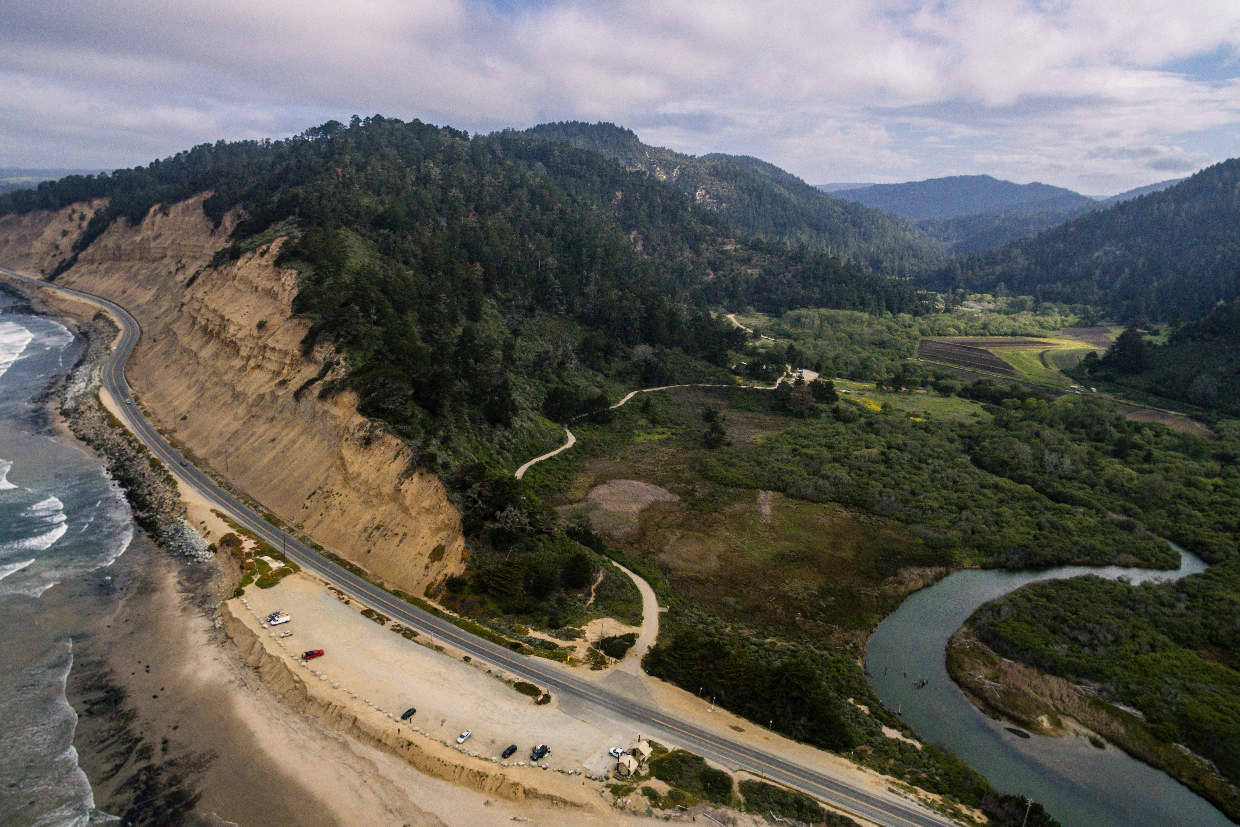
Waddell Beach and Waddell Creek by Drone
Waddell Beach by Drone

DJI Phantom 3, 1/1250sec, f/2.8, ISO 100 [3992x2992]
I’m not sure if anyone is really paying attention but I thought I should address why my new drone photos are taken with my old Phantom 3 instead of the Mavic Pro I was using earlier this year. It’s a bit emberrasing but I suffered a GPS failure on my Mavic while taking photos of the Golden Gate Bridge, I had no clue the GPS had failed so I was still trying to rely on it to fly. The drone of course was not responding to directional commands and would only go up and down, and since I was flying over the bay at the time landing was not an option. I kept trying to tell it to return home to no avail and was restarting my controller etc in a bit of a panic. The wind was taking it further and further into the bay and before I knew it I lost my signal and I never saw the drone again. It most likely ran out of juice and fell into the bay. I was hesitant to talk about this because in hindsight I realized it was a GPS failure and I could have manually used ATTI mode to fly it home. I really should have known to do that, which is why this story is a bit embarrassing for me to tell. I had recently got the drone and was only able to use it for 1-2 months prior to this.
This incident bummed me out quite a bit and it played a role in why my posts on here slowed down to a crawl. Prior to getting the Mavic I had crashed my phantom 3 and messed up the camera gimbal. I was without a working drone for a while but I eventually ordered new parts for my phantoms broken gimbal along with a new range extender kit and fixed up the phantom to be better then new. With the range extender kit I am getting 3x more range out of this thing and I am finally over losing the Mavic Pro. The portability of the Mavic was amazing but it was the long range that really made it for me.
So back to my arial photography assault on the California coastline. I took this shot yesterday while flying the drone at Waddell Beach. I love the steep cliffs on this stretch of coastline, from the sky it provides a really cool contrast from green forest sitting on top. This is also the ending point to the skyline to sea trail as it follows Waddell Creek down to the sea from Big Basin State Park.
Thanks for passing that story on. It may help the rest of us save our drones. I had a similar heart-skipping scare this week when I flew my Mavic into a canyon and under a bridge. I lost all connectivity, but was lucky the drone went into auto-return mode and flew back over the bridge and to start point.
Following for more of your great pics.
Auto-return mode while under a bridge sounds dicey, I'm glad it worked out!
Sorry to hear you lost your mavic! 😔
I’ve been flying drones for 6 years and even now if something goes bad, panic kicks in and I wouldn’t think of going manual. Maybe should practice for unfortunate events like that. Once I even considered a parachute to kick at the push of a button 😅.
I once lost control when my RX antenna broke. Since then I upgraded to ezUHF with a yaggi antenna that gives me up to 15km range!! 🤪
Made a post about my crash:
https://steemit.com/video/@valorforfreedom/how-to-make-a-drone-crash-look-good-minnow-support-saturday-winner-post--video
Forgot to mention there’s a discord channel for drone owners:
https://discord.gg/avvzm
Yeah I have been practicing using the ATTI mode with my P3 now just in case! These DJI drones are suppose to switch to ATTI automatically if the GPS goes out and I was relying on that but I learned the hard way that the GPS can fail without the drone knowing it. Learning the manual override controls is a must!
Gosh thanks for sharing your story @fivealive55. And so sorry to hear you lost the Mavic Pro. :( sounds like I gotta quickly go learn how to do a manual override on my Air...
Don't be embarrassed, we are all learning here. Sometimes the lessons are more expensive than others, unfortunately.
Before I read your story, I was experiencing a severe case of drone envy. I used to live down the coast from you a ways and was just up in Carmel for a bit last week. I have always wanted to see that coastline from a drone's perspective. I don't think they are legal to use there though but such is my mania.
Your shot is gorgeous and wish you success with your new drone.
Yeah, that was a thousand dollar mistake! But lessons were learned and thus is life. The legality of drones is very grey area, technically speaking once you are above 100 feet only the FAA has jurisdiction on where you can and can not fly. The local laws can only apply to taking off and landing. Personally I don't worry about it, I stay away from the big FAA no fly zones like military bases, airports, and national parks. Other then that unless there is signage saying don't fly a drone I will fly it. I plan on flying all over the central coast and Big Sur pretty soon.
I look forward to seeing your shots! I think someone told me because the Monterey Bay is a marine sanctuary drones are prohibited but I may be mistaken because I don't remember ever seeing signage. Drone on and keep bringing us the amazing views!
Congratulations, Your Post Has Been Added To The Steemit Worldmap!
Author link: http://steemitworldmap.com?author=fivealive55
Post link: http://steemitworldmap.com?post=waddell-beach-and-waddell-creek-by-drone
Want to have your post on the map too?