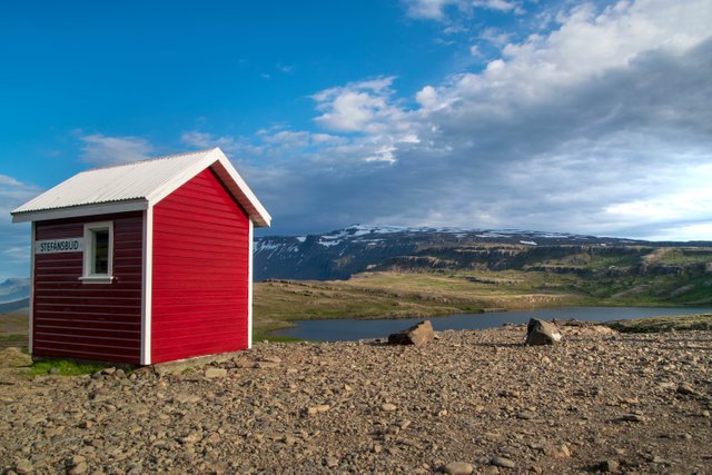
Stefánsbúð
Die Stefánsbúð ist eine Schutzhütte in der Hochebene Breiðdalsheiði.
Viel interessanter als die Hütte und der See im Hintergrund ist eigentlich der Weg dorthin, denn in diesem Gebiet ist die Straße noch nicht asphaltiert.
Außerdem befindet sich die Hütte auf einem Pass und befindet sich etwa 500 Meter über dem Meeresspiegel.
Auf dem Handybild unten könnt ihr die Straße und die Landschaft sehen. Da kann man auch gut erkennen, wie hoch die Hütte eigentlich ist.
Stefánsbúð
Stefánsbúð is a protection hut in the Breiðdalsheiði highland.
Actually, the way there is much more interesting than the hut and the lake in the background, as in this area, the road is not asphalted yet.
Also, the hut is on a mountain pass and is about 500 meters above sea level.
On the mobile picture below you can see the road and the landscape. There you can also see how far up the hut actually is.

This photo was taken by me. Download it for free on pixabay!
Kameraeinstellungen
Kamera: Nikon D3300
Objektiv: Tamron 18-270mm F/3.5 -6.3 Di II VC PZD
Brennweite: 18mm
Blende: f8
Belichtungszeit: 1/250
ISO: 250
camera settings
Camera: Nikon D3300
Lens: Tamron 18-270mm F/3.5 -6.3 Di II VC PZD
Focal length: 18mm
Aperture: f8
Shutter speed: 1/250
ISO: 250
Handybild:

click here for better quality
My other accounts:
@wolkenluchs: New pictures every friday
@cloudlynx: Main account (German)
pixabay: Download my pictures for free
instagram:@cloudlynx


Congratulations, Your Post Has Been Added To The Steemit Worldmap!
Author link: http://steemitworldmap.com?author=wolkenluchs
Post link: http://steemitworldmap.com?post=titel-photofeed
Want to have your post on the map too?
Die Bilder hast du doch von @cloudlynx geklaut!
Und den Namen auch!!! Immer diese Plagiate
Aber immerhin ist es ein kreativer Posttitel!