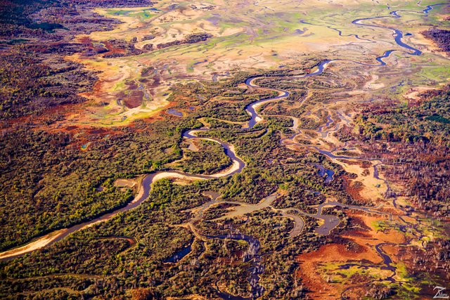
The Little Tallahatchie River
The colors in nature are stunning. I find beautiful places that can only be seen from up above the ground. Once morning as I was flying westbound at a couple thousand feet above ground, just after sunrise on a clear winter morning I came upon this view. These colors were stunning to see when flying above them!
The Tallahatchie River runs 230 miles (370 km) from Tippah County, down through Tallahatchie County, and on to Leflore County, where it flows into the Yalobusha River to form the Yazoo River. The river is only navigable for 100 miles (160km).
Tallahatchie is a First Nations Choctaw name meaning "Rock of Waters." This name derives from the source of the Tallahatchie River which has outcrops of iron sandstone.
From "Where Eagles Fly - The American Wilderness Expedition" my personal project of exploration in the North American Wilderness. I am on a mission to raise awareness of our Iconic Natural Heritage Treasures of North America.
Yehaw!!

Wow what a amazing photo
Whoa so beautiful! it is breathtaking! Nice post :)
Nice skypilot. Thanks for sharing.
Stunning!
Love your posts and the fact that you are directing your efforts to preserve this amazing nature!
Great pictures. I grew up near this area and had many friends along this river.
Interesting project that you have.
Her image is unique. A beautiful panorama. It looks like the picture on the map Whereas the original image
The colors are magnificent
That looks stunning! I’m definitely going to follow you, especially since we both post similar content.
The river is great It's like a snake