SketchTravel to the Scablands
SketchTravel to the Scablands of Central Washington
Road trip through the Channeled Scablands of Washington State

Washington State is pretty big and varied. Rainforest mountains on the coastal Olympic Peninsula. Puget Sound lowlands where Seattle is. Cascade Mountains, which fall away to the eastern desert. Then into the Palouse farming lands. Finally into mountainous land again as you get to the Idaho border.
In the heart of this, there is an enormous area that has been gouged out, cut in places hundreds of feet down into the basalt bedrock. It looks like the southwest cowboy country, completely out of place. Turns out it was all created by an enormous flood (or several) that occurred around 12,000 years ago. That is at the end of the ice age, where giant two-mile thick glaciers that were pushing way down into Washington state stopped and receded, melting very quickly.
The largest recent geologic event to occur on earth
An ice dam around Missoula, Montana formed, blocking the Clark Fork River. And the melting glacier water collecting behind it formed a giant lake 2,000 feet deep and as large as Lake Erie. When this dam burst, all that water rushed out crossing Washington State as it made its way to the Pacific Ocean. This is how what is called the Channeled Scablands was formed. It is considered the largest recent geologic event to occur on earth.

On the road
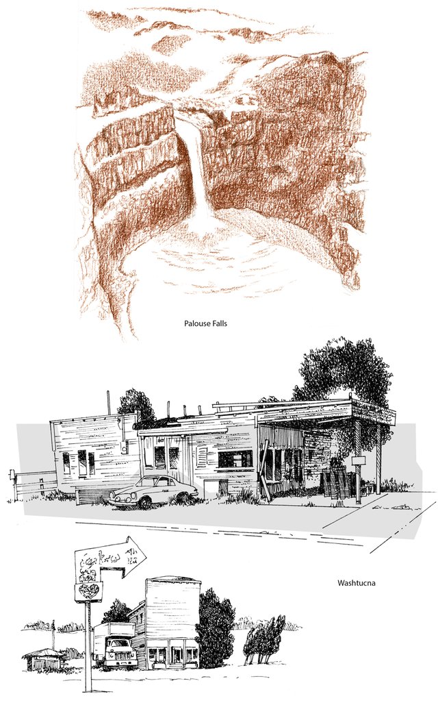
We drove over the Cascade mountains at Snoqualmie Pass and on out into the land where the forests thin out and farmlands take over. Then that land gives way to desert – sagebrush country that is somewhat rocky and more fit for cattle ranching than farming. We crossed the enormous Columbia River at Vantage and turn south at Moses Lake to cover the rest of the way to our first destination of Palouse Falls on the blue highways – the little secondary roads. Just before Palouse Falls I stopped for a couple sketches in the dusty little empty feeling town of Washtucna. Empty buildings, junked cars and farm equipment, grain elevators, railroad tracks, cool stuff.
Palouse Falls
Typical of this country, Palouse Falls is an enormous basin carved from the flood. Today it has the Palouse River running through the canyon. But it is not large enough to have ever carved this area. In fact the falls were eroded back 5 miles during the flood. An awesome place to visit. You park right in front of it, but signs warn you of how many people have recently died falling off the cliffs and going off the trails. There is a YouTube video of someone going down the falls in a kayak. It’s completely crazy. Google it if you want to see it.
for my sketches: ©All Rights Reserved @mrsomebody
On to Dry Falls and Sun Lakes
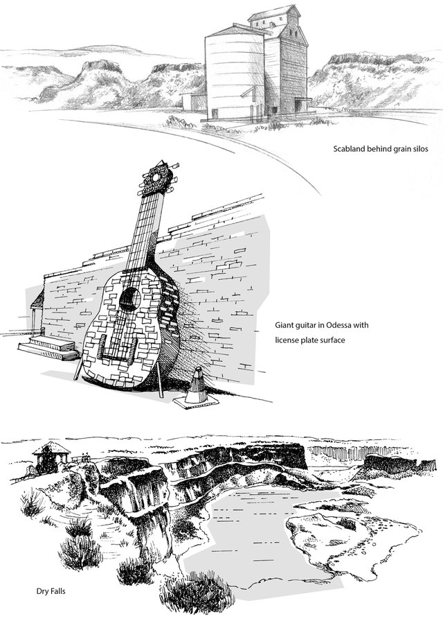
We stayed in Ritzville just off the 1-90 freeway. After dark we drove a few miles out of town into the farm fields where we could see stars and the milky way, which you can’t see in Seattle. Next day we went north, looking around the sleepy farm town of Odessa before going west to Soap Lake and up the coolie to Sun Lakes-Dry Falls State Park. These are generally long shallow lakes left in the basin from the flood. Dry Falls has a visitor center and viewpoint where you can take in the entire area. It almost feels like a mini grand canyon from there. It is 5 times larger than Niagara Falls, and at its peak they claim the water ran 300 feet higher than the rim, so that you would not even know it was a falls, just an enormous torrent of water.
A map of the flood path, and where we drove

I created these maps too because I am a graphic artist! If you are interested in learning more about the channeled scablands area and geologist J. Harlen Bretz, who formed the hypothesis of it, a Google or YouTube search will give you plenty to explore. There is a good amount of information available.


Hello this artwork is featured on the 7th Issue of Steem Sketch Book on this blog : The Art of Monotone and Lines : Steem Sketch Book's 7th Issue of Featured Artworks
Thank you for contributing the awesomeness of art here on Steemit!
Follow @steemsketchbook for more upvotes, resteems and contests
thank you @steemsketchbook! I am a follower.
Wow, simple and very beautiful sketches!
Thank you for sharing your wonderful journey.
@shibasaki Thank you very much. I like your watercolors a lot. They're such a challenge for me though!
This post was shared in the Curation Collective Discord community for curators, and upvoted and resteemed by the @c-squared community account after manual review.
@c-squared - Thank you!
really nice post ! always a treat, actually, to see you post, @mrsomebody :)
love all the illustrations and the text, also ... a gorgeous travel experience seen through your art and words <3 beautiful !
Thank you so much @veryspider. I am lucky that this area is so easily accessible from Seattle. I am really drawn to the stark, rugged beauty of the area as well as the old, dusty, almost forgotten towns you come upon on the backroads. There is so mush more to explore!