You are viewing a single comment's thread from:
RE: Doorjam Gulley Exit - An adventure in getting off trail - part 3📷
Wow what an adventure! Great!!!!!
550 paracord...oh yes I have done that too. Very, very dicey(it can't take much more than a tiny fall) and after I did it I began to carry 100ft of 8mm canyon rope on all my mountain bushwhacks (3 1/2 pounds not too bad). You are much farther down the climbing road than me of course, just amazing!:)
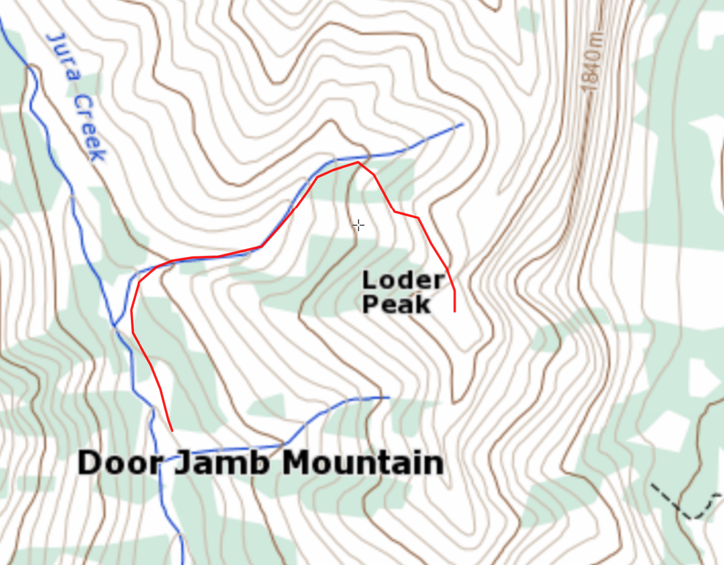
This looks like the route you took?
I do a fair bit of map recon before bushwhacks usually although I wing it too sometimes. I'm guessing you encountered the huge headwall near the bottom where the elevation line Vs sharply uphill which would be where the stream was back cutting. (sorry for this nerdy bit, I like to study a trip, especially afterward to understand the land better for the next time).
good question, not weird at all, I do the same in studying terrain maps from routes I've explore (or will). The red route you marked is the common exit from loader peak and eactually quite a good one. Its steep, but no bad cliffs or drops. I've done it before, which led me to think I could then also try the gully just south of loader, but still north of door jamb. The second blue streem on your map. Right down at the V, it had the drops we faced even though it didn't look quite as bad as the northern common route. However. haha.
Good idea on the 8mm rope, my buddy has an older climbing rope he's planning to upgrade, so we are going to cut a couple emergency sections from that to use/carry on questionable routes (and to get to/from caves of course that HAVE to be explored, haha)
Ah. More feet per mile won in the teror contest :). Those maps don't always help on cliffs. The lines fuzzing together thing isn't always there...or I don't notice lol.
Check! Caves must be explored:)